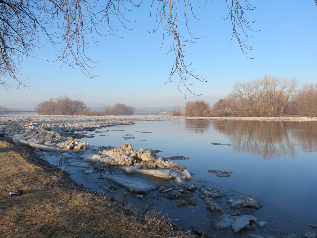
– view westward from Riverside Park playlot – 15Jan2014

An article in today’s Schenectady Gazette about backed-up ice from North St. in the Stockade to Rexford, tells us that “The sun glistening on the ice-packed river was a stunning sight.” (“Residents along riverfront keep wary eye on ice,” by Kathleen Moore, B1, Jan. 16, 2014, posted online Wed. morning, Jan. 15). Unfortunately, the article comes with only one photo, and it was taken at Freeman’s Bridge. Kathleen was definitely right about the beauty on the River, and I think you’ll agree after viewing our Slideshow below, which naturally focused on the Stockade portion of the Mohawk River. [Click on the free-standing (outside the Slideshow) photos for larger versions, which help demonstrate the beauty.] There’s much more ice-jam beauty in our posting from Monday January 13.

. . .

 . . a pair of ducks could not resist the sunshine
Mystery? But, before the beauty, I want to mention a mystery playing out along our stretch of the Mohawk the past few days, as depicted in the following following photos and collages:
immediately below: photos taken [L] Jan. 13; [R] Jan. 14
 . . .
. . . 
. and
 . . . Jan. 15, 2014
– above: For three days (Jan. 13, 14, 15), a mass of ice was “stuck” between North St. and the Western Gateway Bridge (and perhaps as far upstream as Rexford), although there appeared to be nothing but clear, flowing water for its trip downstream. Even the often-culpable piers of the CSX trestle were clear. The downstream edge of the ice mass was in the shape of an arch and spanned both banks of the River.
 . . .
. . . 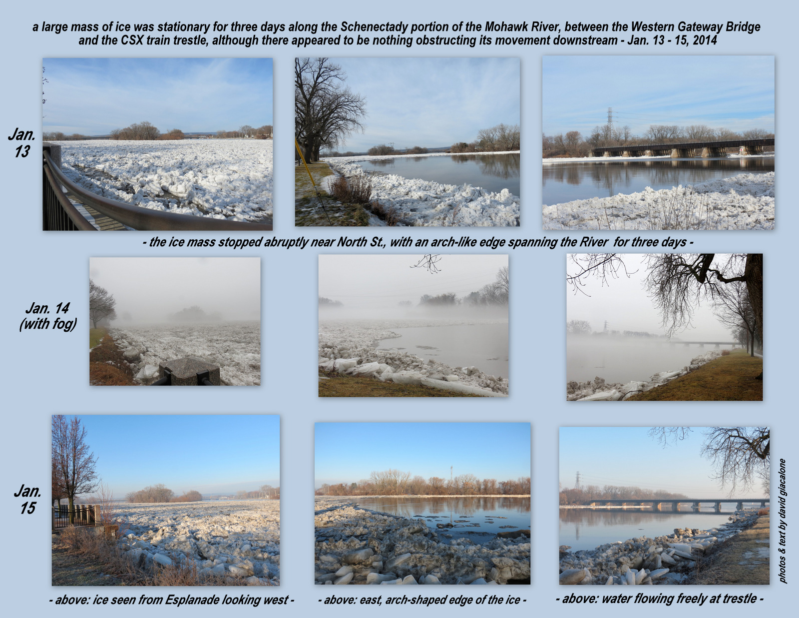
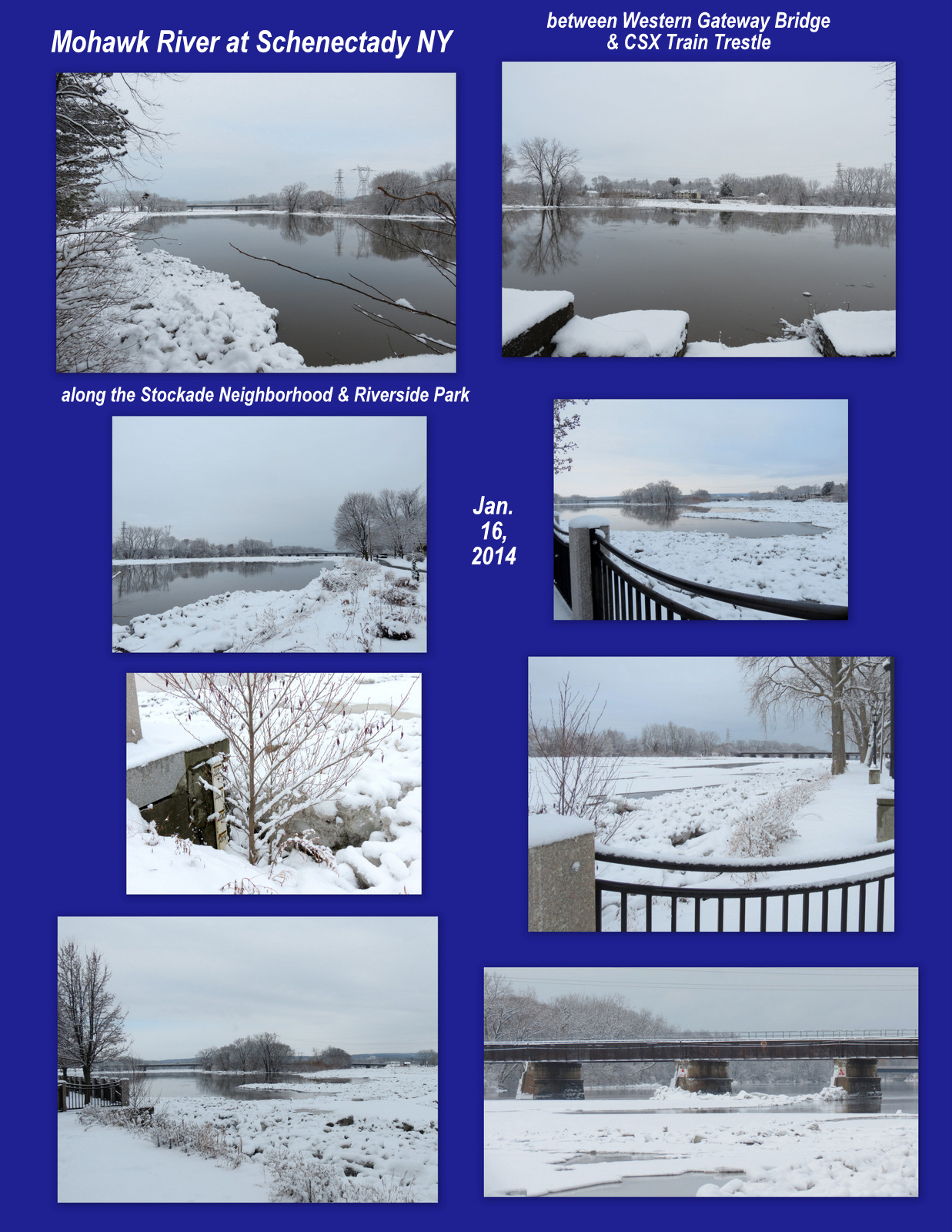
– collages showing: [R] the ice mass, arch-shaped edge, and flowing water at the CSX trestle, each day Jan. 13 -15; [L] the mass largely broken up this morning, January 16. Click on the images for a much larger version.
Is there a riparian hydrologist in the house? Can you explain how this wedged-in ice phenomenon happened? The multi-talented Mark Fisher, strolling the Park near his North St. home yesterday, pointed out that the strength of the arch structurally might offer an architectural explanation for the refusal to budge. Any facts or theories resolving the mystery would be appreciated. [see update at foot of this posting]
.

.

. share this post with the short URL: http://tinyurl.com/IceJamBeauty2
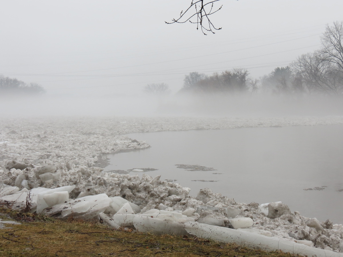
 Finally, one more mystery (at least for me of limited scientific expertise): How did the “ice ditch”, with perfectly perpendicular sides get formed alongside the shoreline, near Governor’s Lane? Despite the fog, I’m certainly no machinery was secretly used to carve the formation. Mark Fisher helpfully suggested that the Binnekill, which empties in the Mohawk closeby (between Cucumber Alley and Gateway Landing), has its own current, running at a different speed and depth than the Mohawk. That difference might have brought about the separation from the mass of ice. I’ve often wondered why there would so often be unfrozen water near the shoreline behind Washington Ave. and Cucumber Alley, and around the old Burr Abutment. The Binnekill current — which was surely bursting with snow and ice-melt — might indeed be the answer. Please feel free to comment. The following collage shows pictures related to the “ice ditch” issue.

update re “Mysteries” (Jan. 17, 2014): At the brand new Mohawk Ice Jam Camera (reported in today’s Gazette, here), I found an email address for Gary Wall, a hydrologist with the U.S. Geological Survey, based in Troy. I wrote Mr. Wall last night asking if he could explain the Stuck Ice Floe and the Ice Trench mysteries. He wrote back this morning:


Leave a comment