
– two segments of Western Gateway Bridge behind Isle of the Cayugas –
Note: click here for our post on restoring the Bridge’s View and Guardrails
If done correctly, my two main hobbies — taking photos around the Stockade and writing haiku poetry — require keen observation and should, at a minimum, sharpen that skill over the years. As often happens, however, life keeps me humble and demonstrated again last week that I need to pay better attention to my surroundings. The object of this lesson was the Western Gateway Bridge, which spans [1875 feet] the Mohawk River on NY Route 5, from State St. in Schenectady to Mohawk Avenue in Scotia. [You can find information on the bridge’s history in the Postscript located at the foot of this posting.]
Here’s the sight that undermined my confidence:

– midsection of WGB, seen through the Isle of the Cayugas (Nov. 15, 2009) –
For the twenty years since I moved to Schenectady and its Stockade district, my view of the Western Gateway Bridge [“WGB”] has been from the east, in Riverside Park or my backyard on Washington Avenue in the Stockade. For that entire time, I have seen only two segments of WGB from the Stockade — one on either side of the Isle of the Cayugas, which is situated under the Bridge. The trees of the forested island block the view of the middle section of the bridge from the East. For example, see the sunset photo at the top of this posting, which was taken only 6 weeks ago, on October 3, 2009. In early November, however, I looked at WGB from near the kiddie playground of Riverside Park, and for the very first time also saw a middle section of the bridge.

– three segments of Western Gateway Bridge (November 15, 2009) –
When I first spied that middle section, I was in Riverside Park with Sylvie Briber (and her dog Lollipop). Sylvie, the long-time editor of the Stockade Spy, has frequented the Park for years. Neither she nor I could remember ever seeing/noticing that third section of the Western Gateway Bridge before that evening. However, when I breathlessly told another friend who lives along the Park about our amazing “discovery,” she insisted it’s been visible other years after the leaves fall, and that we simply have not been looking from the right angle or perspective — or not paying enough attention while enjoying sunsets beyond the Bridge.
Last Sunday, after a couple of weeks of uncertainty, I remembered to check my own photo library (which only dates back to the Spring of 2008) to see if that middle section has in fact been visible before this autumn. Indeed, it was — at least last winter – as can be seen, if you look closely at these two photos (click to enlarge):
 …
… 
– middle section of WGB seen after Dec. ’08 ice storm [L] and March ’09 ice jam –
Here are two more photos of the mid-bridge segment, the first from the street near 16 Washington Avenue, and the second from the backyard of 10-16 Washington Ave.:

. . .

. . . . . . . .
Please let me know in a Comment whether you’ve previously seen the elusive middle section of the Western Gateway Bridge from the Stockade side of the bridge. If so, did it happen last winter or in prior years? If this is a recent phenomenon, do you know what changes on the Isle of the Cayugas allow this third view of the Bridge?
 In addition to snapping this photo of our neighborhood’s infamous black cat last Sunday (November 15, 2009), my quest to learn more about the third section of WGB had one excellent side-effect: It got me to take my first photos ever from the Western Gateway Bridge. Here are two views of the Stockade seen through that opening on the Isle of the Cayugas (as always, click on a photo to enlarge it, scroll over it for a description):
 . . .
. . . 
In addition, you can see some striking views of the Stockade riverfront, taken from the middle section of the Western Gateway Bridge, by going to our next posting “Stockade riverfront seen from the Western Gateway Bridge.”
 follow-up (9 AM, Nov. 20, 2009): Loraine, our highly observant Commentor-friend, suggests that the mid-section of WGB is now visible because “the 6 to 8 feet tall grasses are dying and matted down giving the view of the middle section of the WGB. If you look at the Isle from the bridge, you won’t see trees in the middle, but just the matted down tall grasses.” She has a point: Here’s a mid-Isle view from mid-Brige:
”
. . 
My eyes (and, right now I only have use of one eye, so my vision is hampered) must be playing tricks on me, however, as there sure does look like trees at the far eastern tip of the Isle in the photo take October 3, 2009:
 . . .
. . .
Perhaps that greenery is mostly high grass, as Loraine suggests, with a few short trees. See this photo of that end of the Isle taken from the Bridge on Nov. 15, 2009:
. . . 
This still leaves me with the question: Has the middle of Isle of the Cayugas been clearcut of its trees within the past couple of years, or has it been this way for many years?
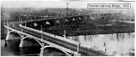
P.S. Background on the Western Gateway Bridge: According to “Bridging the Mohawk”, by John Gara and John Garver of the Union College Geology Department:
“1926 marked the condemnation of the Burr Bridge to Glenville as the $2.5 million Western Gateway Bridge was dedicated on 6/16/26, a year after the first cars began crossing its 4515′ span. [click for a photo of the 1926 Western Gateway Bridge] . . .
“[I]n 1971, the Western Gateway Bridge was replaced with a girder style bridge [of the same name] with five lane widths, sidewalks and bike paths east of the 45 year old concrete bridge. The Binne Kill branch of the Mohawk was filled in (now parking for Schenectady Community College) so that the bridge would only have to span 1875 feet with the rest of the roadway on an earthen dike.”
“Bridging the Mohawk” contains more information on the history of bridging the Mohawk from Schenectady to Scotia. For example, there was some tragedy involved in the building of the first Western Gateway Bridge in the mid-1920s. (also, see our prior post about the Burr Bridge)

I think it is more that the 6 to 8 feet tall grasses are dying and matted down giving the view of the middle section of the WGB. If you look at the Isle from the bridge, you won’t see trees in the middle, but just the matted down tall grasses.
Last fall (2008) my friend Lynne Jonell (author of the Emmy middle reader series) borrowed my canoe to paddle out to the Isle of the Cayugas. She was doing research for her next book which will be set in Schenectady and should come out in 2010. She told me that the island is mostly tall grasses. I was very impressed that an author of children’s books who lives in the mid West would put so much work into researching the background for a children’s book.
By: Rain on November 20, 2009
at 7:37 am
Here is a tale you could add to your story. When the bridge was being built the concert let go and fell into the river. Many workers were injured. One man is still buried in the concert.
My dad had a garden below the bridge, he ran for his life or he would been buried.
Also past the bridge going toward Lock 8, the water went around toward Jumping Jack, around the circle was a beautiful swimming spot with white sand. Anyone who had boat transporation on a hot summer day would be there.
By: Helen Witts on November 26, 2009
at 2:08 am
Thanks for your anecdote, Helen. I think there is a version of the bridge collapse story in the article that is linked above in this posting, “Bridging the Mohawk.”
I’d like to see a photo of the white sand and swimming spot. I’m going to see if I can find one.
By: David Giacalone on November 26, 2009
at 2:44 am