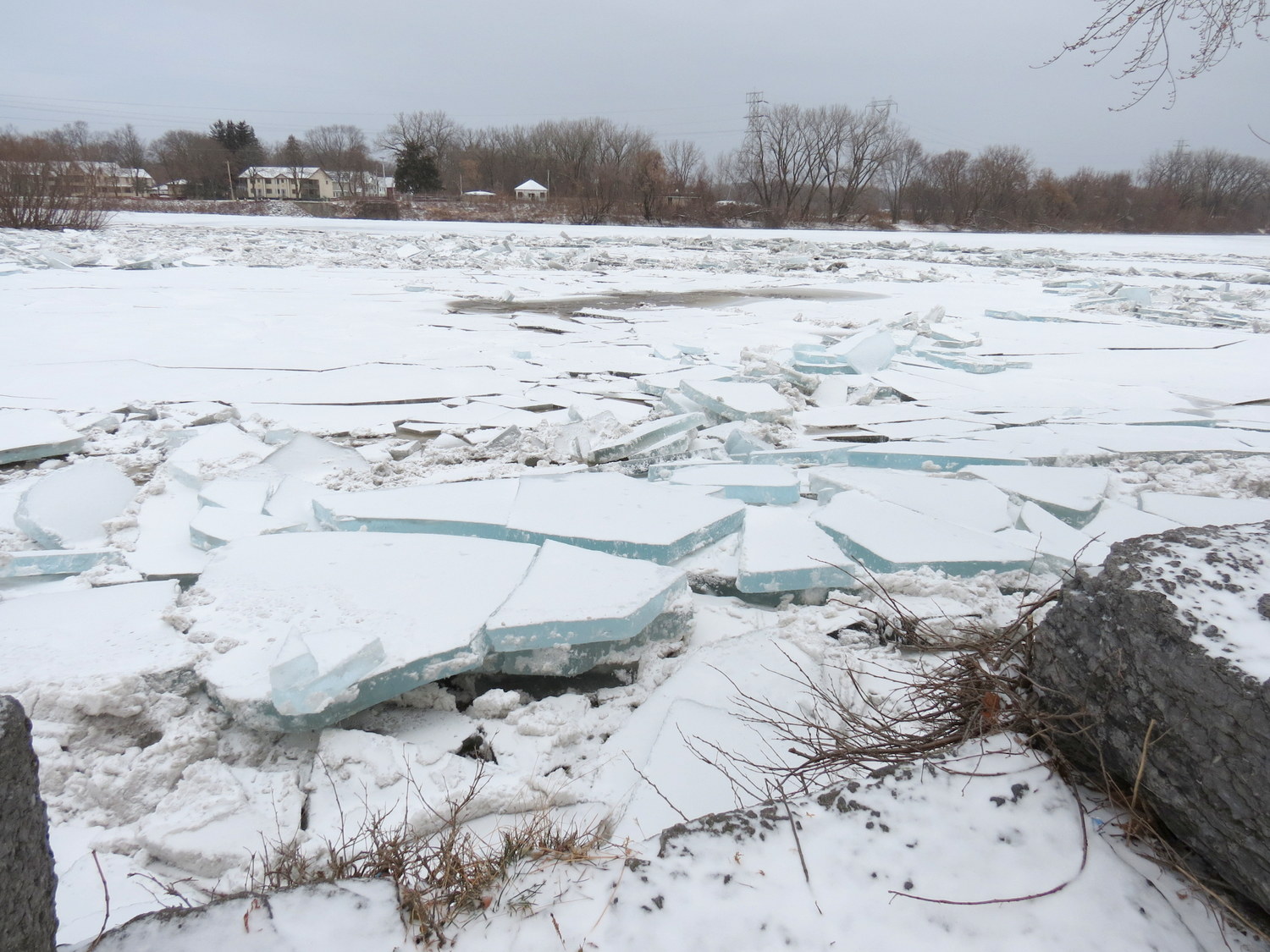
follow-up: Click here to see ice floe conditions a week later, Jan. 19 & 20.
flooding update: Monday, January 15, 2018
 . .
. . 
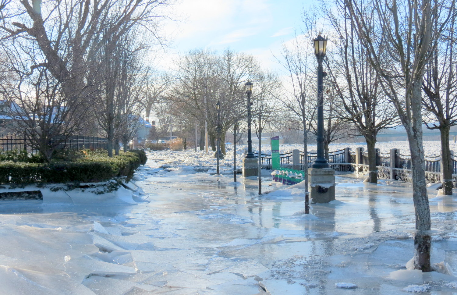
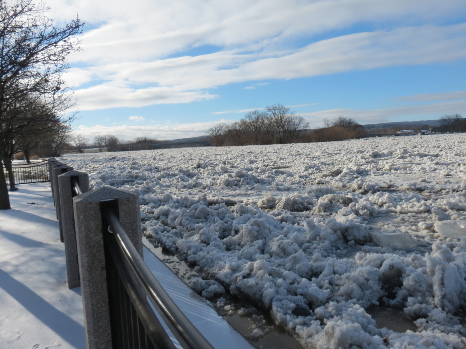
. . above: Riverside Park Overlook/Esplanade, Monday, 2:30 pm; seen on WTEN with Steve Caporizzo. .
The River continues to fall, and the NSW shows it at about 4 feet below flood level Monday evening. Ice has been removed from the roadways that were flooded Saturday night, but temperatures have preserved frozen floodwaters elsewhere, creating interesting effects. Below is a 40-photo Monday Slideshow, with the icy Esplanade and Park, and the invaded rear of Cucumber Alley featured.
– THREE-DAY WEEKEND, MONDAY-MLK DAY SLIDESHOW –
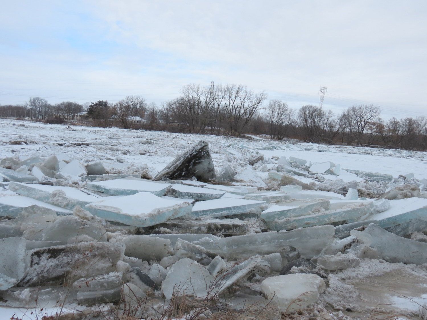
 . west end Riverside Park, Monday, 2:15 pm
.
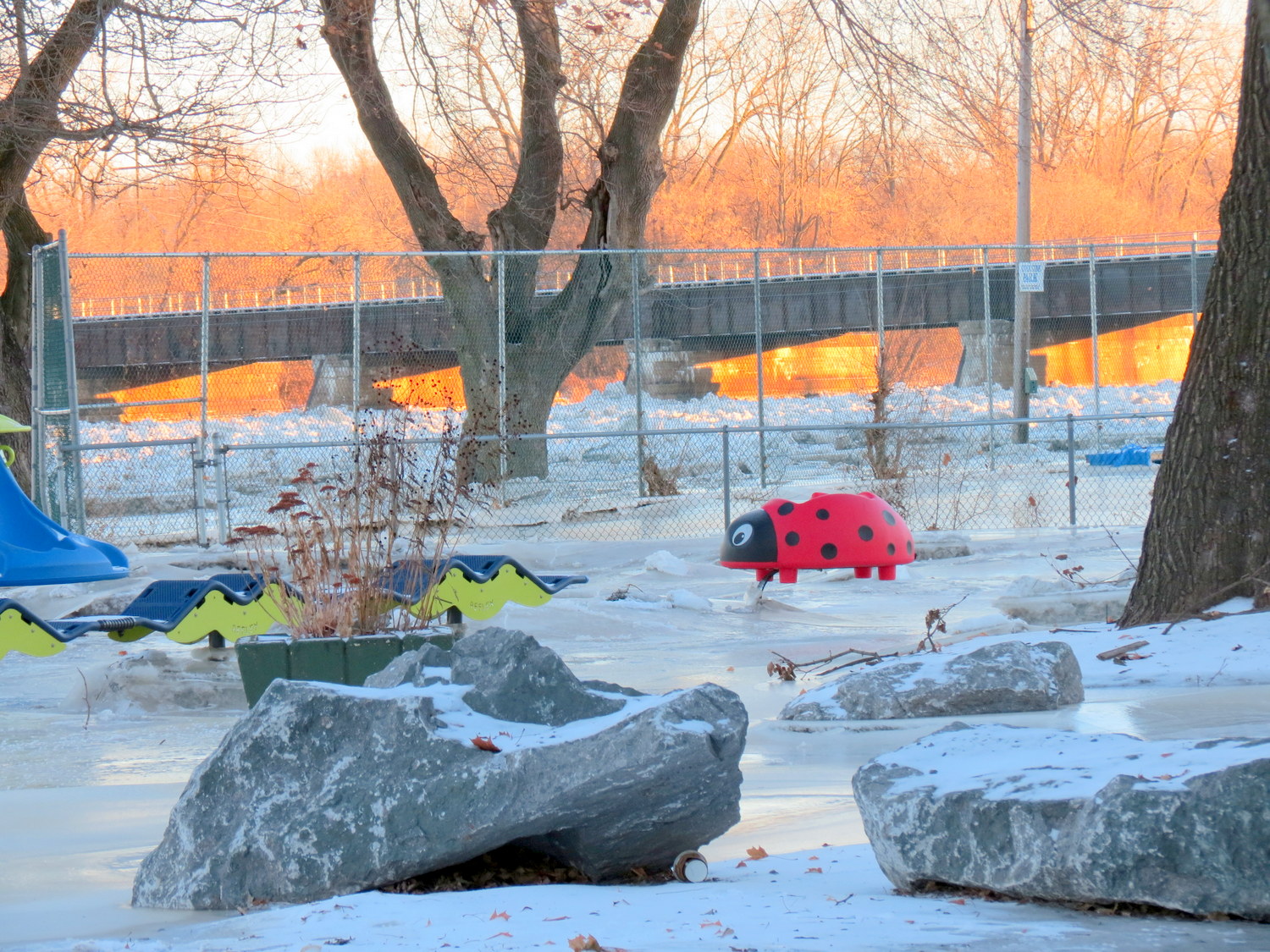
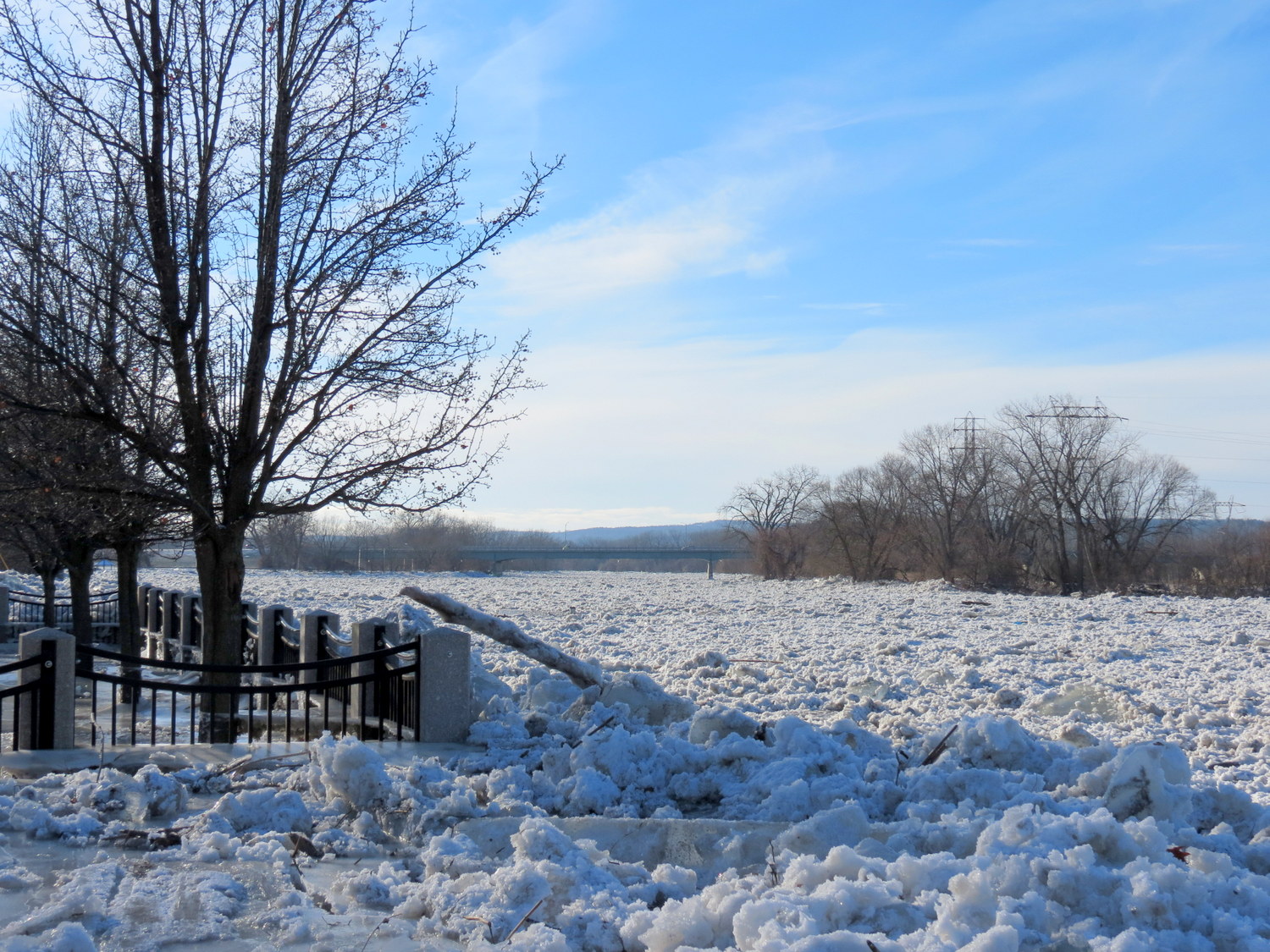
Park playlot and CSX trestle
SUNDAY MORNING UPDATE

3pm Sun.
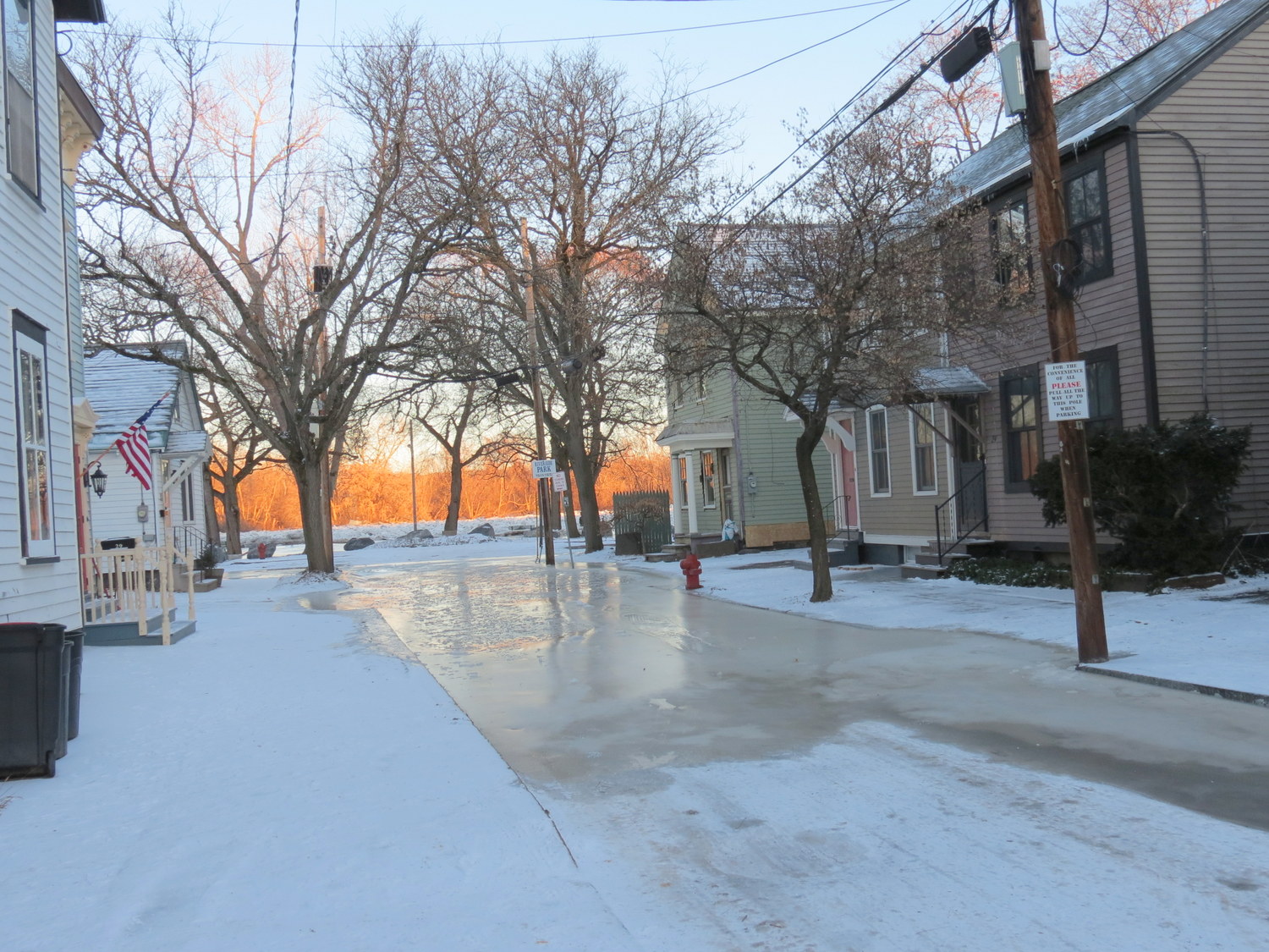
The Mohawk River has been coming down very slowly overnight (see National Weather Service chart) at Schenectady, and is likely to be below flood level by early this afternoon [Note: In fact, at 11:45 am, the Mohawk fell below flood stage and is predicted to continue falling.]. Last night and this morning, the ice jam has been stationary, with occasional cracking sounds. By late Saturday night, frozen river water covered Riverside Park and came onto Ingersoll Ave., North Ferry Street, the parking area at the end of Governor’s Lane, as well as the end of Cucumber Avenue. This morning, ice covers each of these narrow roadways, and they may remain icy throughout Sunday and Monday, given the frigid forecast, unless City crews break up and remove it today. (see today’s TU coverage) Temperatures were near zero at sunrise Sunday, with uncomfortable wind chills.
Nonetheless, I took an early photoshoot stroll of the flooded areas, and the results are below. Scroll down further for Saturday’s full photo and video coverage.
Share this posting with this short URL: https://tinyurl.com/StockadeJam
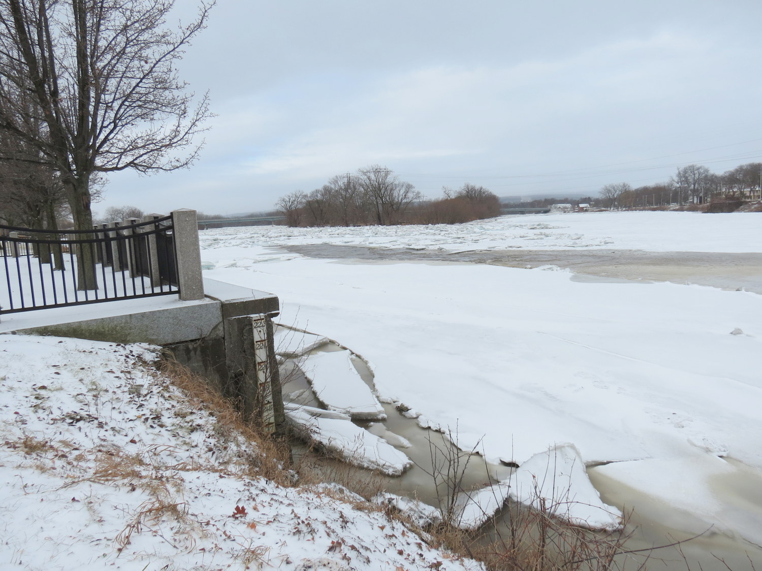
. . North Street, 8 AM Sunday
Sunday Slideshow – photos taken 7:30 am to 8:15 am. Note: for a larger version of a Slideshow image, pause on the photo, right-click, and choose Open Image in New Tab
. . Esplanade . 
 . . looking east from west end of Park

west entry to Riverside Park, Sunday 8:15 am
. . .
SATURDAY, JANUARY 13, 2018
Saturday update (3:30 PM): The ice floes have stopped flowing for now, but the water level is at flood stage (top of the riverbank), with some water in Riverside Park. See 2 dozen photos in Slideshow II below. Here’s a sample:
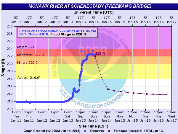 update (Midnight Saturday): The ice field is stationary, with shallow water covering Riverside Park. The latest National Weather Service water level report (image to the right) shows the Mohawk having peaked, and continuing to decline, with the expectation that it will be lower than 220.0 ft, flood stage, by noon on Sunday. (Sunday, 8:30 AM): The Gazette and Times Union tell us that Ingersoll Ave. and North Ferry St. had some flood water last night. I will have photos up at this posting later Sunday morning.
Original Posting
 . . .
. . . 
. . above: scene at Riverside Park esplanade [L] 10:17 am; [R] 10:35 am . . thank you, Times Union for using both photos online Saturday afternoon .
When I got to the end of Washington Avenue and the entryway to Riverside Park at 10:12 am today (Saturday), the Mohawk River was totally still, with stationary chunks of ice crammed together and askew. Twenty minutes later, the ice layer had cracked and the River was a fast-moving torrent of water and ice floes, with many pushing up along the Riverbank.
. . share this post with this shorter URL: https://tinyurl.com/StockadeJam
. . go to this posting to see what was happening yesterday, Jan. 12.
This video clip was taken at 10:37 AM:
.
- I will be adding photos to this posting until early in the afternoon.
Such power:
 . . . stationary floes, along the former Burr Bridge abutment, 10:12 am, at the end of Washington Avenue,
 . . west end of Riverside Park, 10:36 am, fast-moving floes
The next short clip shows how large ice floes can be pushed up onto the Park itself, as also happened in February 2010.
.
This Slideshow has photos presented in the order taken this morning, between 10:12 am and 10:38 am.
STAY TUNED.
Two O’Clock Saturday Stroll
My second (and last) Park stroll of the day produced some pretty pictures, along with discovering that:
- the top of the ice field had stopped moving
- with water creeping up Cucumber Alley, and filling the yards of both Alley houses;
- and, it had reached the flood stage along the Stockade river banks,
- with some water flowing into Riverside Park, but not past the pedestrian walkway, and mostly on the lawn right at the edge of the riverbank. See for yourself in this Slideshow #2.

river end of Cucumber Alley, 2:15 pm Sat.
note: for a larger version of a Slideshow image, pause on the photo, right-click, and choose Open Image in New Tab
.
 . . view west from east end of Park

near Governor’s Lane

esplanade, 2:30 pm Saturday

Leave a comment