 . .
. .  .
.
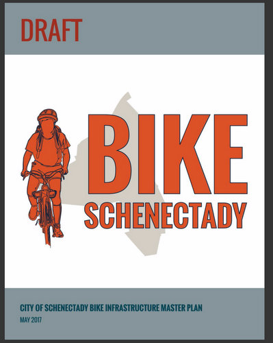
 A Shared-Use Path in Schenectady’s treasured Riverside Park? The Safety & Comfort of all Park Users (as well as cyclists), and the Soul of Riverside Park, are at Stake, if more and faster-moving bicyclists are allowed on the Park’s only walkway, as is proposed in Bike Schenectady, “The Schenectady Bike Infrastructure Master Plan” (2017) . The significantly increased volume of traffic, change of pace, and reduction in safety are likely to create a “scared-use” path, frightening away many current users, especially the most vulnerable (the very young, the elderly, and disabled, and their caretakers), as well dog-walkers, sunset-seekers, and romantic strollers. For the majority of current Park users, it will end or spoil practices enjoyed for decades by many generations, without measurably improving the City’s bicycle infrastructure. As is argued in the Gazette OpEd column “Preserve Riverside Park for pedestrians” , we should instead preserve, promote, and enhance what is best about Riverside Park by officially making it a Pedestrian Sanctuary.
 . .
. .  Share this posting with the shorter URL: http://tinyurl.com/RiversideBikes2

Procedural Update (Oct. 17, 2017): The Final version of Bike Schenectady, the Schenectady Bike Infrastructure Master Plan, was posted without fanfare at the City’s website on September 5, 2017.
It was approved October 18, 2017, by the City of Schenectady Planning Commission (with its Chair, Mary Moore Wallinger recusing herself due to her leading role as designer and proponent of Bike Schenectady). Peter Knutson, representing the City’s Department of Engineering, assured the Commission that no segment of the Planned network would be constructed without first having more public comment on specific plans, after assuring that design guidelines are met.
The proprietor of the website submitted Comments to the Planning Commission re Bike Schenectady, asking the Commission to recommend changes or additions to the Plan explaining the types and needs of pedestrians and protecting Riverside Park from imposition of a shared-use path, without at least first having a study of its pros and cons and impact on the Park and its users. The Planning Commission ignored the recommendations.
 Bike Schenectady‘s Final Version was adopted by the Schenectady City Council on December 11, 2017. See “Schenectady bike infrastructure plan adopted: Master plan includes 3 phases” (Daily Gazette, by Stephen Williams, Dec. 12, 2017). As fully discussed below, the Plan’s Bike Path Policy section (at D-11; see thumbnail image at the head of the paragraph) states that “The current codes for the City of Schenectady prohibit bicycle use of paths and trails within the parks in the City.” It therefore calls for the City Code to be amended to permit, with adequate safeguards, the use of park paths by bicycles. [Nonetheless, as of April 4, 2026, no such amendments were ever proposed, much less enacted, by the Mayor or City Council.]

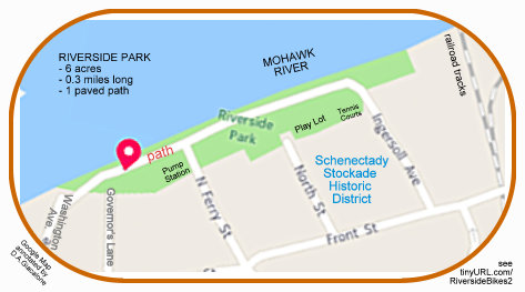
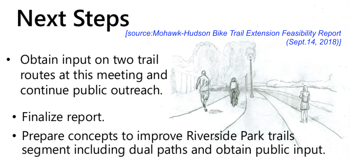
 update (June 22, 2018): You can see our summary of the County’s Trail Extension Feasibility Study, here. Its suggestion of giving Riverside Park a two-path reconfiguration, separate paths for pedestrians and for cyclists, seems promising when compared to converting the existing walkway into a shared-use path. Of course, we need to see details to evaluate the impact on the Park and its users, and may conclude that allowing bike traffic is simply too much of a risk. [Note: The two-path configuration, seen in the thumbnail image at the head of this paragraph, was never seriously considered or approved.]
Original Posting
 . . . Tomorrow, Thursday, June 29, 2017, the City of Schenectady will unveil and explain Bike Schenectady (Draft), the Schenectady Bike Infrastructure Plan. [click here to see the Final version.] The public presentation of what is surely a near-final Bike Schenectady Plan makes the issues raised at this weblog last year very timely and the concerns quite urgent: see the post “does a bike path make sense for Riverside Park” (short URL: tinyurl.com/RiversideBikes). That post has been updated because of the release of the Bike Schenectady Plan, with additional description of the current-traditional activity on the Riverside Park path.
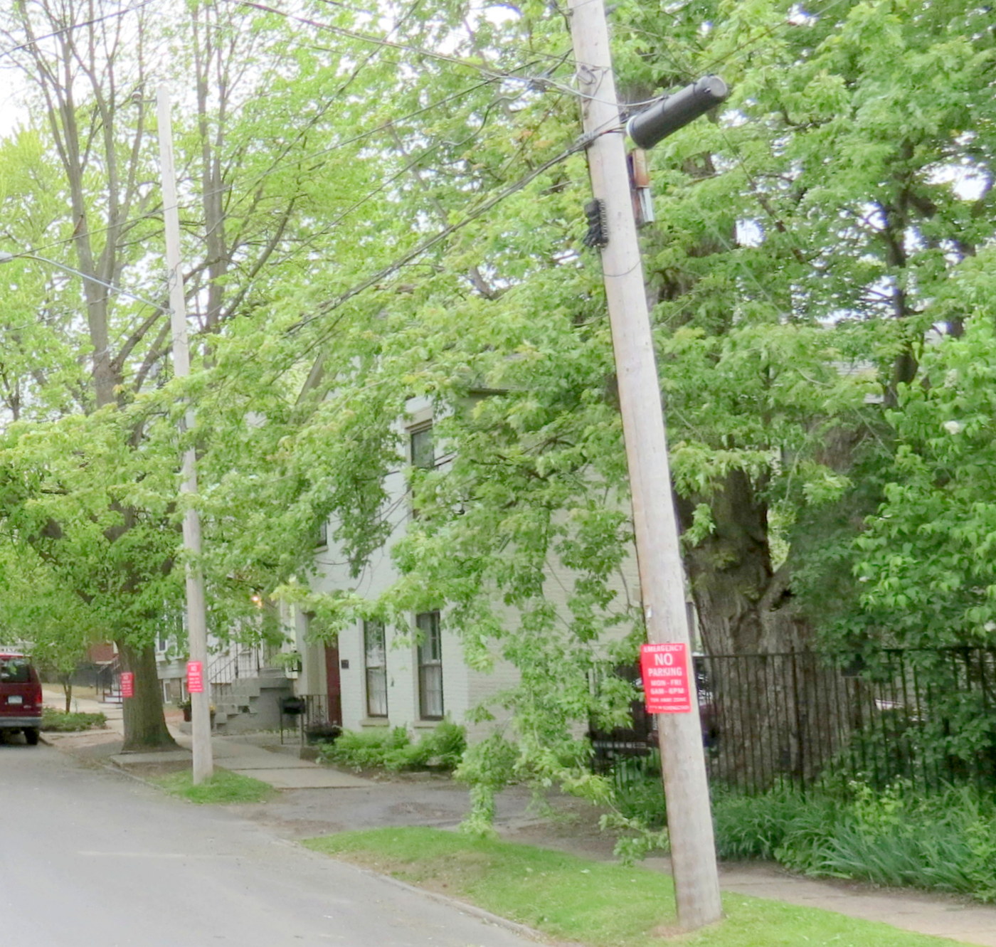
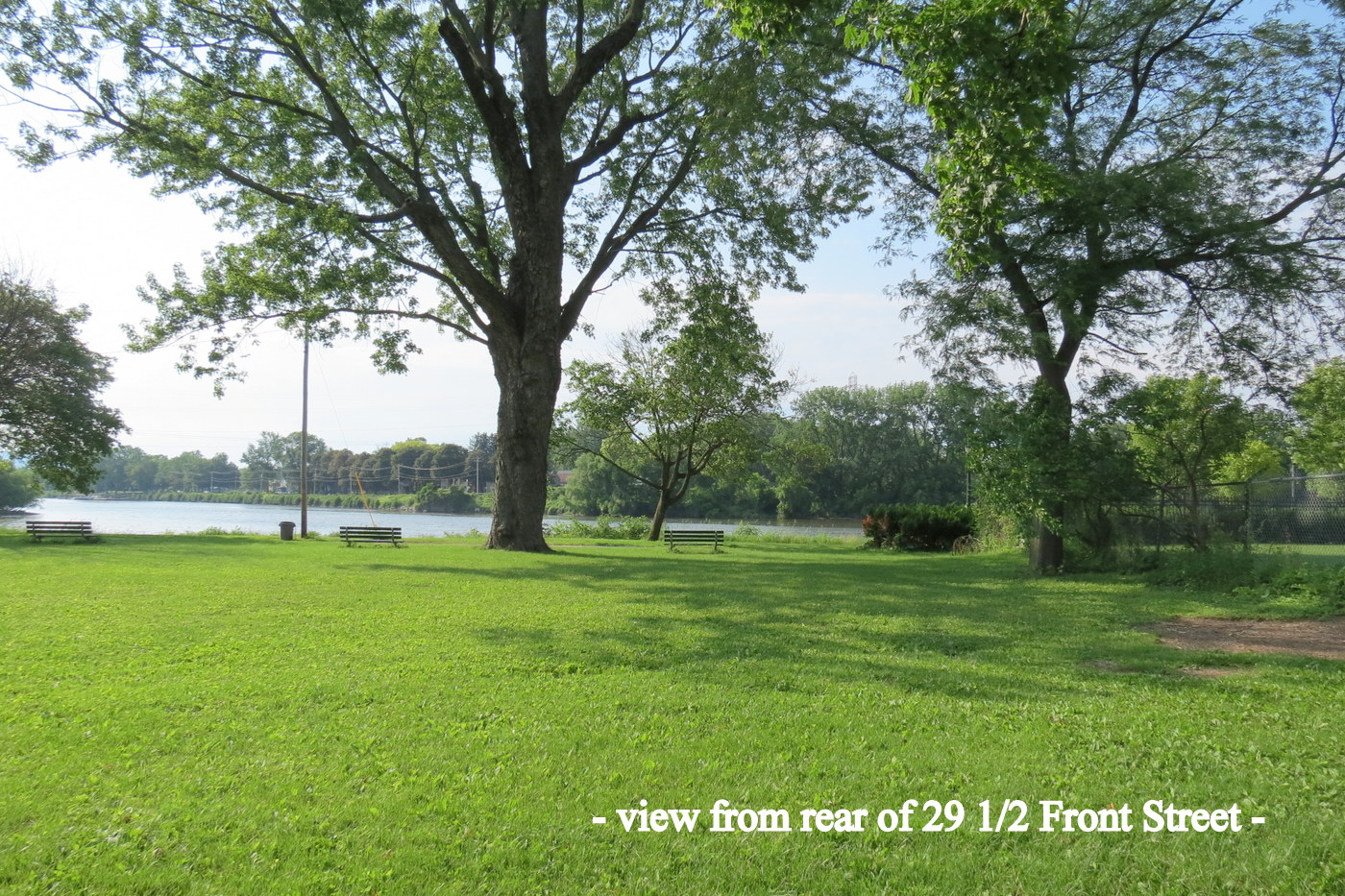
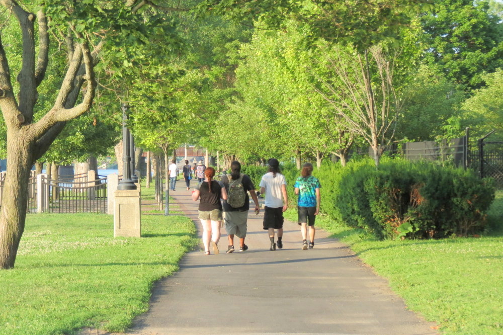
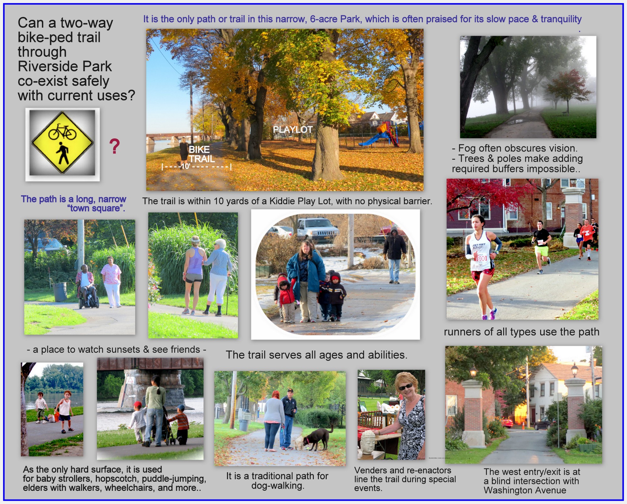
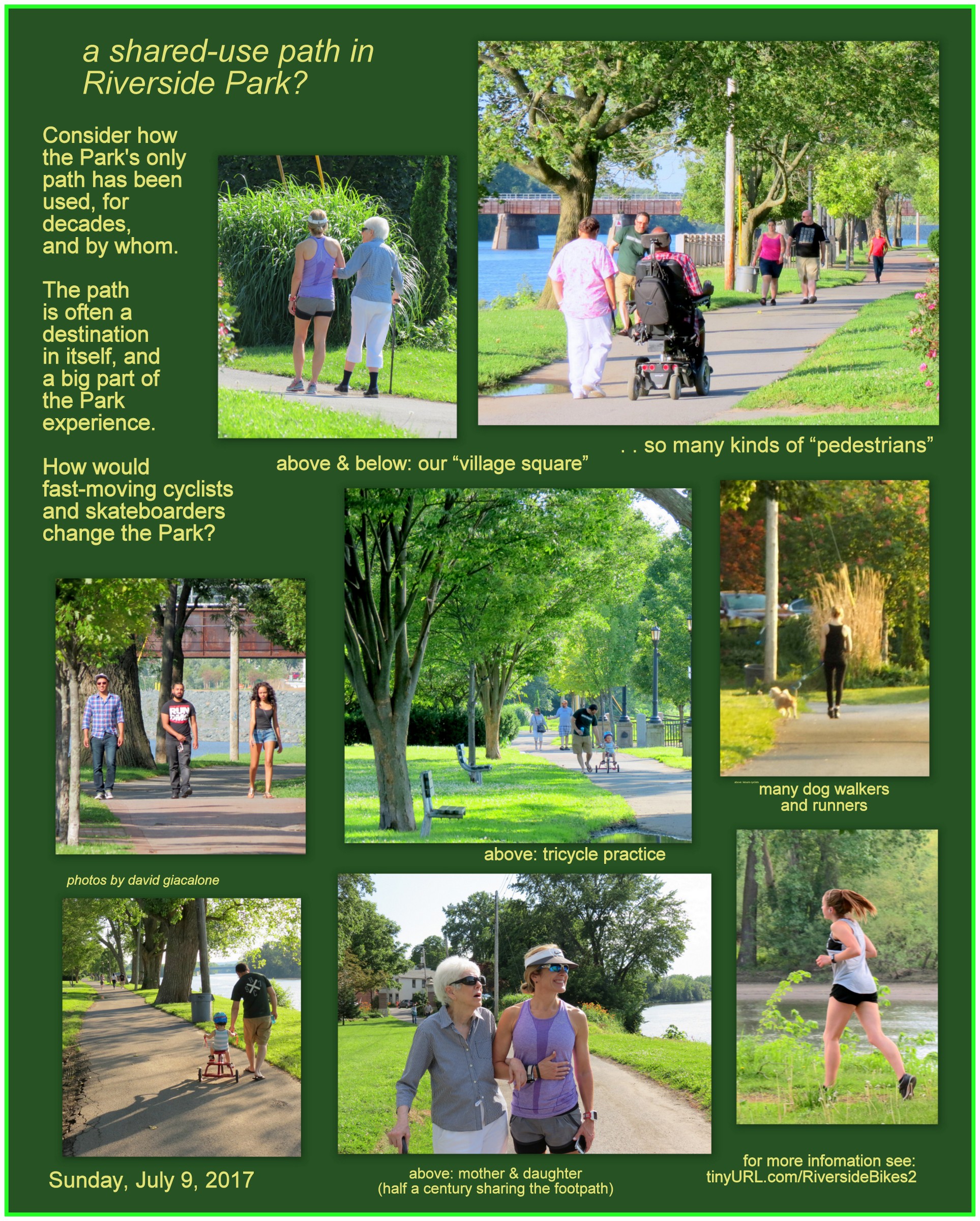
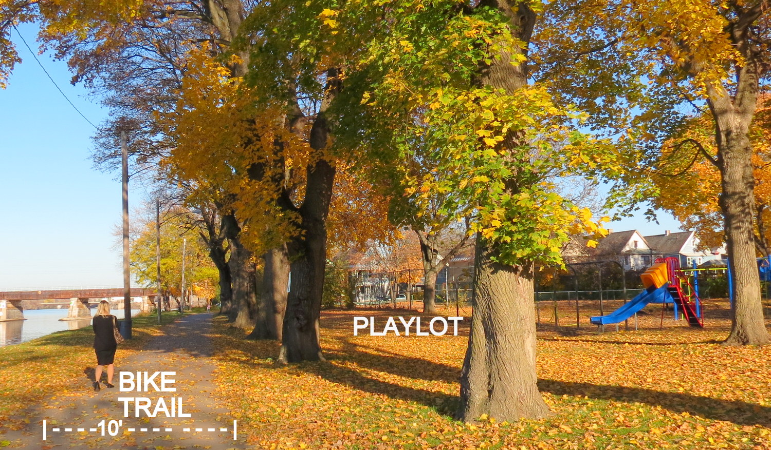
 The prior posting, like this one, calls into question the conversion of the only paved path in a small, treasured neighborhood park (which is listed on the National Register of Historic Places), into a shared-use path to be used for two-way travel by cyclists and people on foot or in wheelchairs. The Riverside Park path has been used for generations by people of all ages almost like a “public square”, for many passive-park purposes. Bike Schenectady would make it into a “keep-moving”, connector & transportation thoroughfare, purposely attracting many cyclists seeking to move, in both directions, as quickly as possible through the Park, on its 10-foot wide path. A path that is an integral part of the enjoyment and experience of Riverside Park is, we fear, likely to become so unsafe and uncomfortable that it will scare away a large portion of its current users.
- This piece focuses more directly on Bike Schenectady, recapping important points from our earlier posting, describes the Path, the Park, and their use and users, in more detail, along with DOT design standards for multi-use paths, and City Code sections relevant to bicycles and parks, and it contains more discussion, photos and images.
below: Detail showing the Mohawk Harbor-Stockade portion of the Schenectady Bicycle Infrastructure Plan Map . .

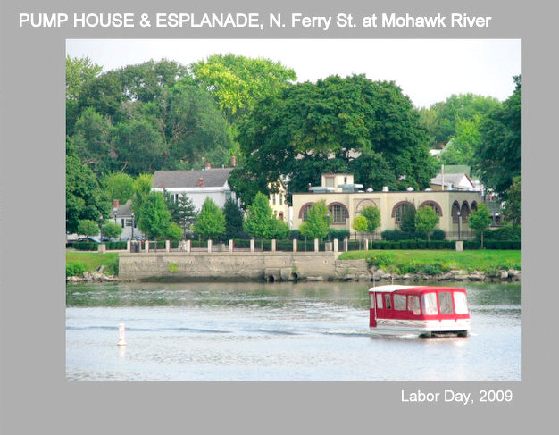
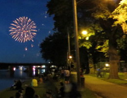
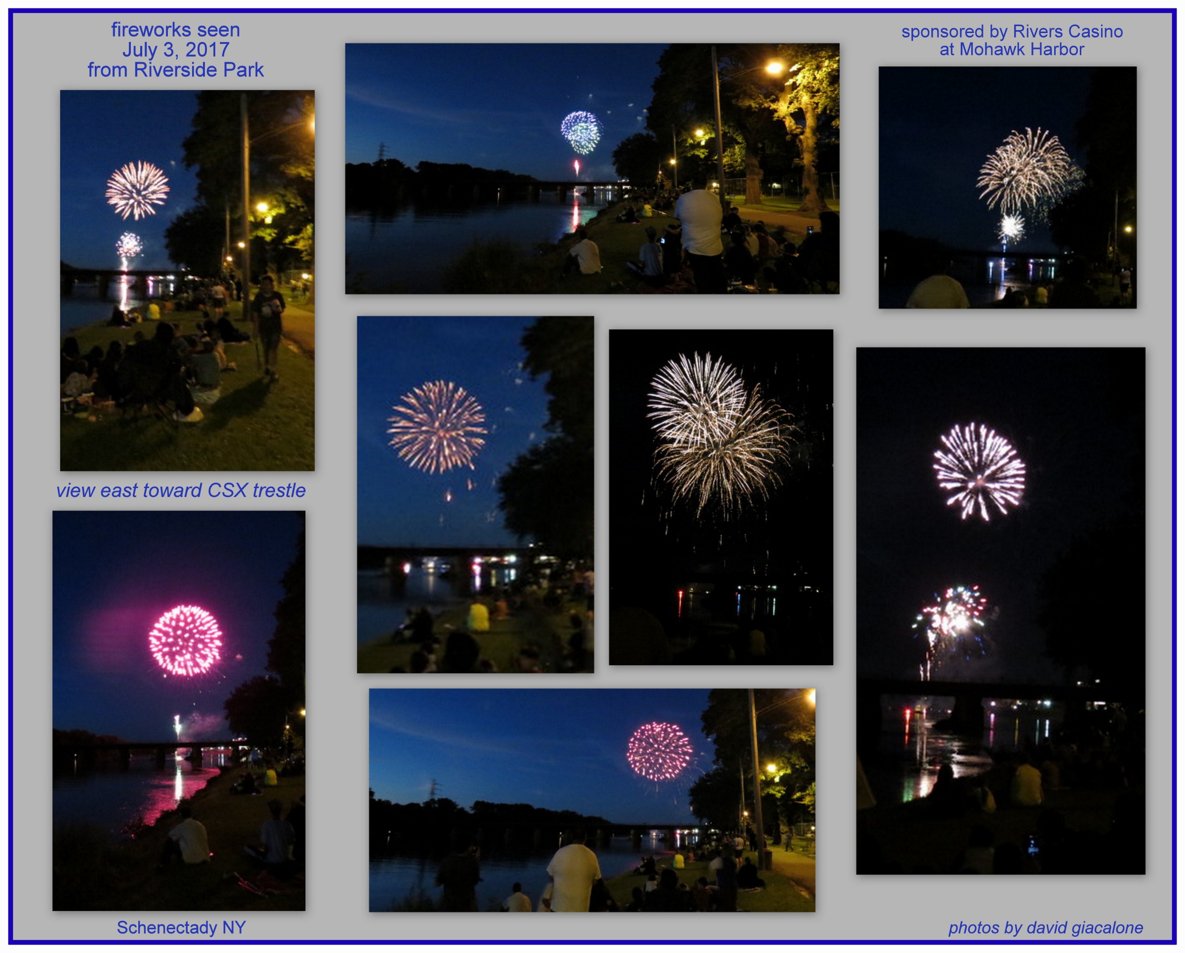
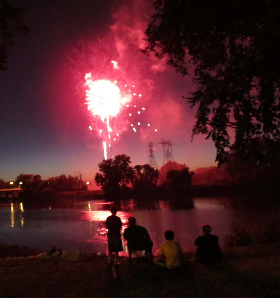
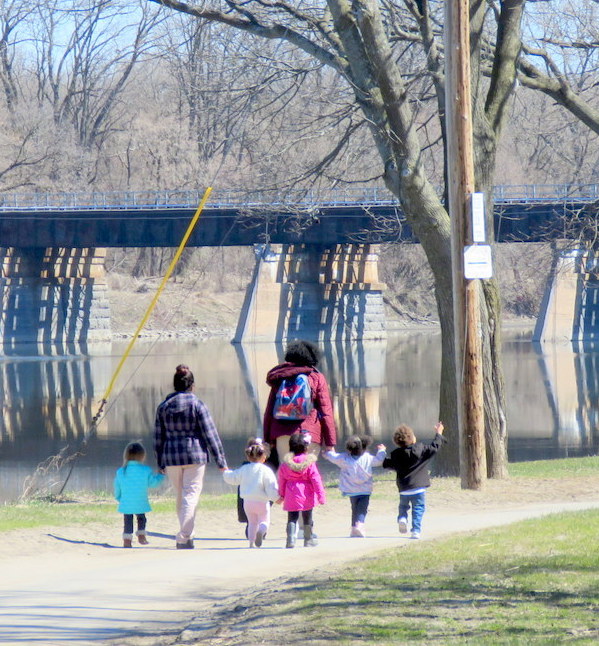
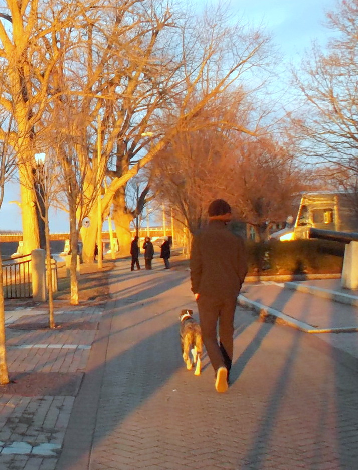
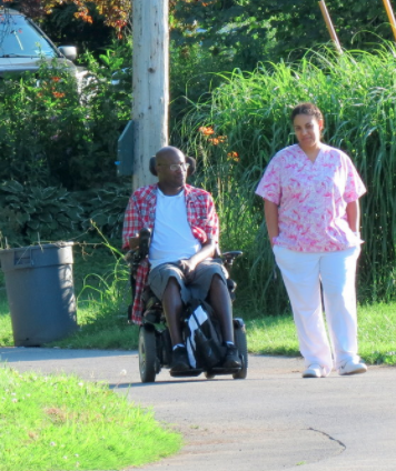
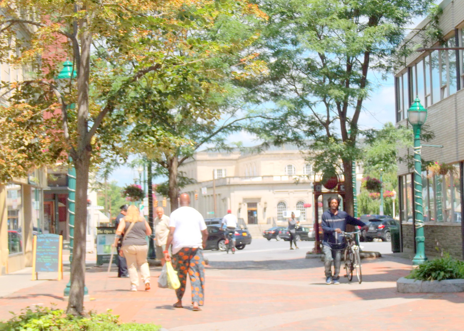
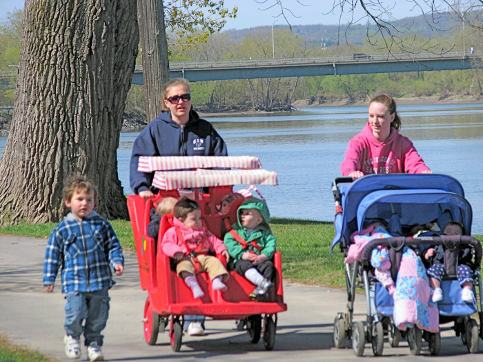
Slideshow of Users, Uses, and Conditions. Several dozen images of the Riverside Park path, with its many kinds of users and uses, can be found in the following Slideshow [which has been supplemented with additional scenes from a quiet Sunday evening in the Park, July 10, 2017, and Sunday afternoon, Earth Day 2018.]. Any decision about bringing large numbers of cyclists to the path and the Park must consider the impact on the current usage and users.
This slideshow requires JavaScript.
.
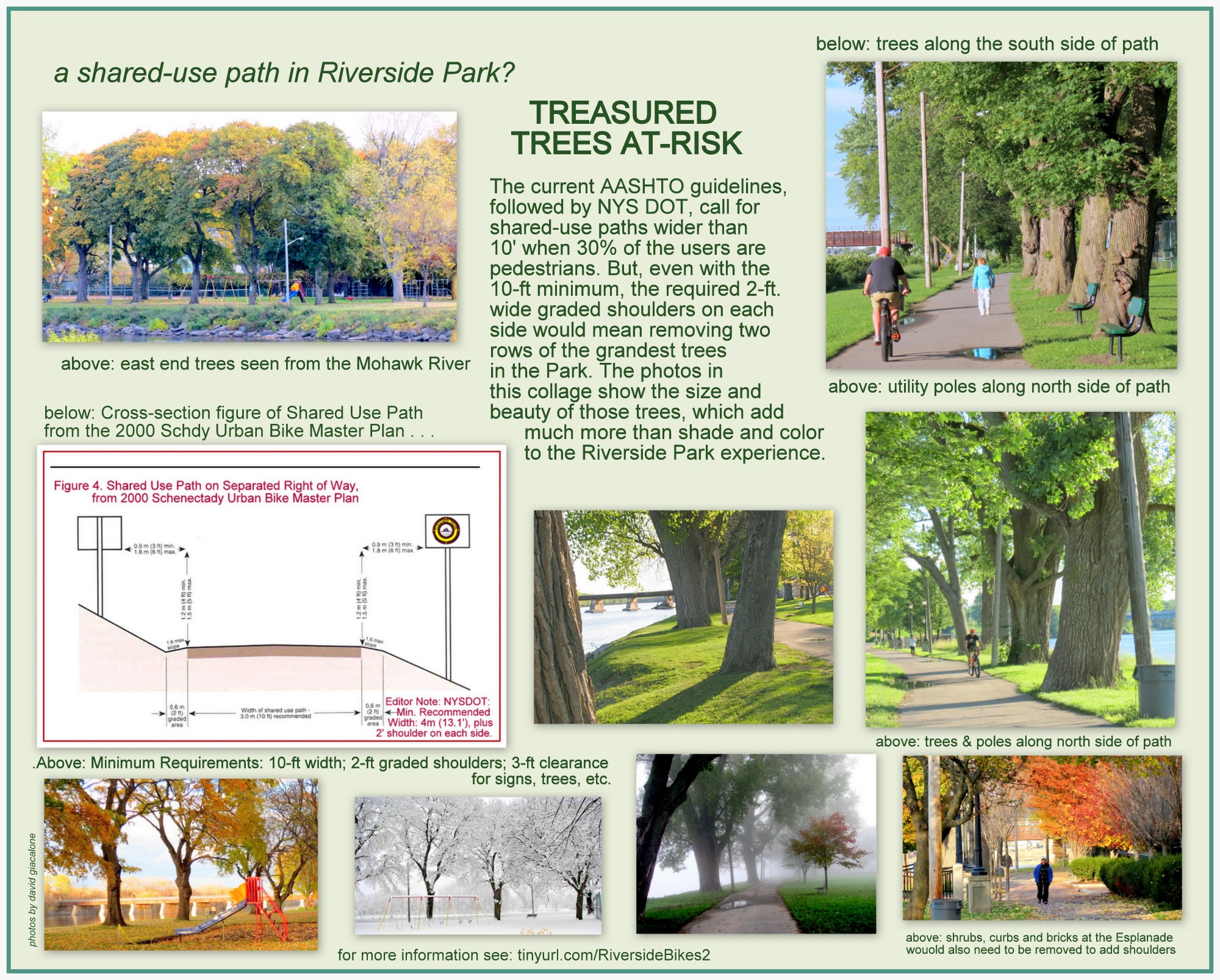
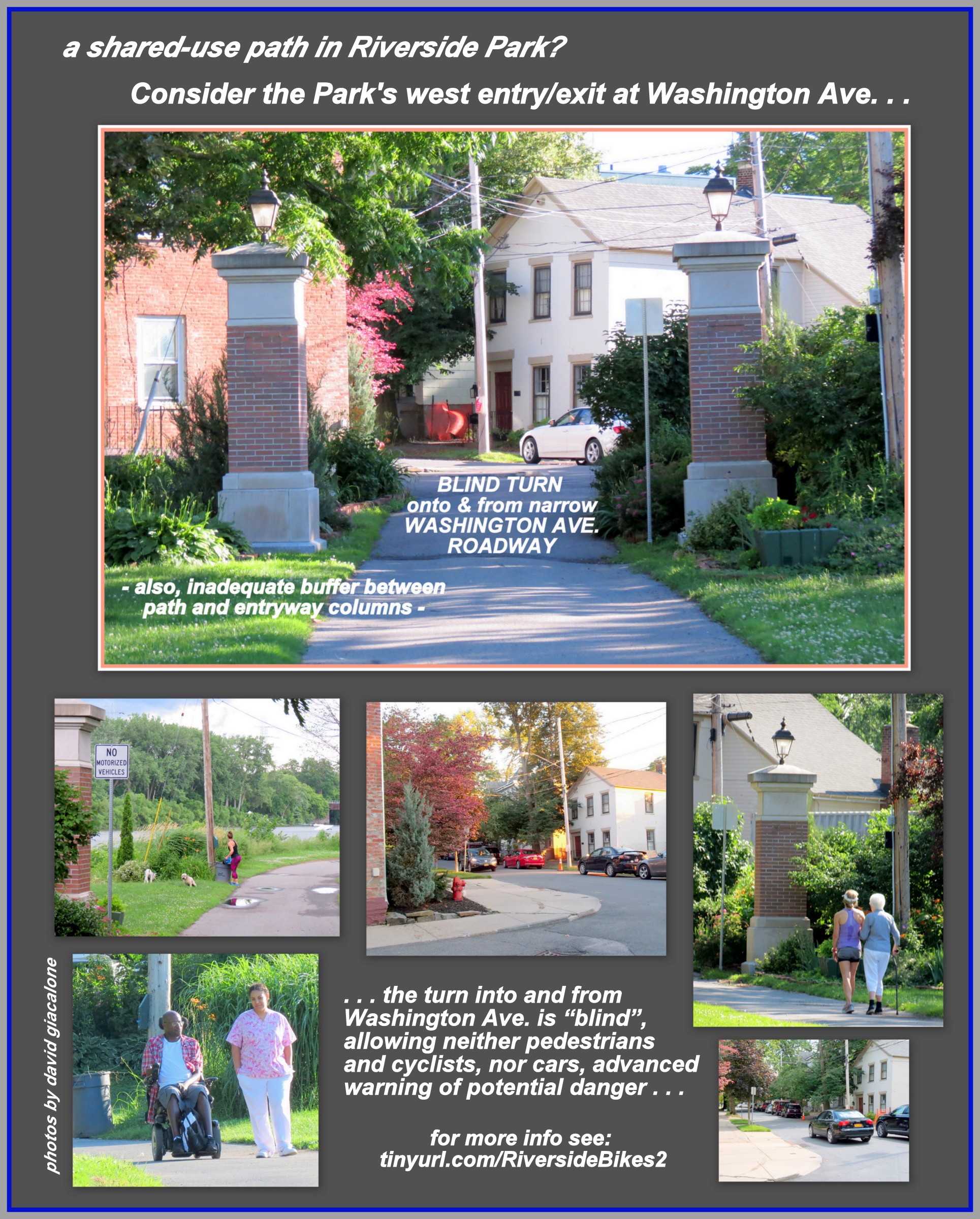
The collages immediately below raise just three of the many factors to consider when deciding whether a Shared-Use Path could be made safe enough to make it appropriate for Riverside Park.
 . .
. .  . .
. . 
Collages above: [L] Treasured Trees at Risk; [M] Sunday Users and Uses; [R] Unsafe interface with Washington Avenue. Click on each for a larger version.
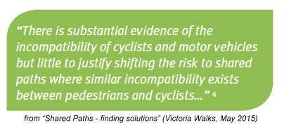
Victoria Walks, an Australian walking-advocacy coalition, has extensive experience with shared-use bike-ped paths in Melbourne. After reviewing the literature and research, Victoria Walks has come to important conclusions quite relevant to whether a shared-use path makes sense for our Riverside Park. See Shared paths – finding solutions (Victoria Walks position paper, May 2015), which is based on its comprehensive research paper, Shared paths – the issues. And, see “Footpaths are for feet“. Here are some quotes from Victoria Walks on Shared-Use Paths:
 “Victoria Walks has significant reservations regarding shared paths and how they impact walking, particularly by more vulnerable walkers. Generally, slow moving recreational cyclists may be able to share paths with walkers. However, walkers do not generally mix well with commuter or sports cyclists, who typically travel at higher speed.”
“Road managers should avoid converting footpaths to shared paths, as they may be ‘designing out’ the most vulnerable road users – older walkers and those with a disability.”
“Shared paths are commonly built for both bike riders and walkers, but they can be an uncomfortable place to walk, especially for children, disabled or older people.”
“I’m old and not very nimble — it’s [a] frightening silent menace.”
[Elderly] “For those aged 75 and over, walking makes up 77% of their total physical activity. . .. The study included a survey of 1128 senior Victorians – 39% rated bicycle riders on shared walking or cycling paths as a moderate to major constraint to their walking. Cyclists on footpaths will deter seniors from walking and limit their ability to live their everyday lives.”

[Goal] Victoria Walks strongly supports: “The community and government working together to find solutions for both walking and cycling, while ensuring pedestrian safety is not compromised.”
[Speed] “Evidence suggests that cyclists do not necessarily slow down when they share a path with pedestrians. A study from Sydney and Newcastle found the average speed of cyclists on footpaths was 21 km/h [13.04 mph], exactly the same speed as cyclists on roads with a speed limit of 50 km/h [31 mph] or less.”

Existing Analogy  . .
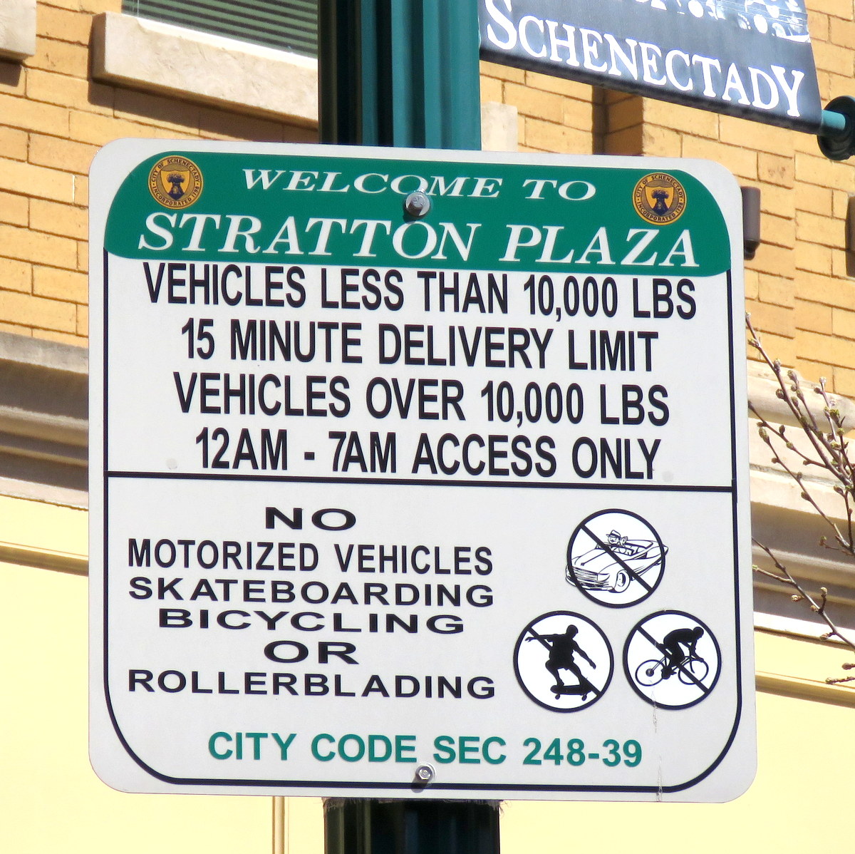
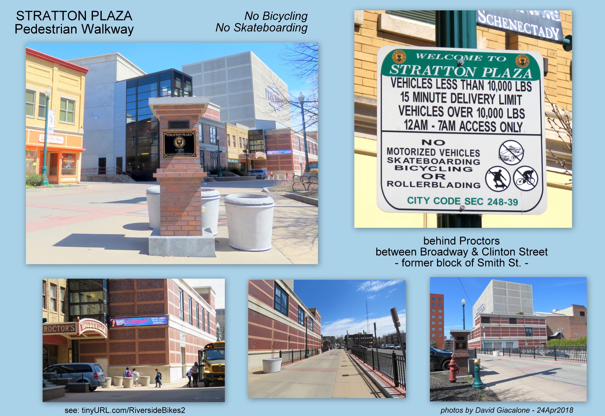
. .  Wouldn’t continuing the longstanding ban on riding bicycles on the path of Riverside Park, and enforcing the Ordinance, serve the same purposes (safety, comfort, peace of mind of people using the space while on foot, etc.) as Schenectady’s ban on cycling on both the wider, more street-like Jay Street Pedestrian Mall and Stratton Plaza (behind Proctors), which also was once a City street?

. . Jay Street pedestrian walkway – No Bicycling, Skateboarding Allowed . .
 . . also at Stratton Plaza .
. . cyclist walks bike on Jay St. [R] . . 
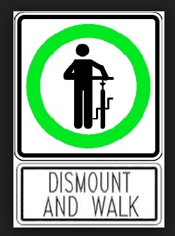
 . . even bike-oriented colleges know the advantages of walk-only zones on paths with many pedestrians . .
.

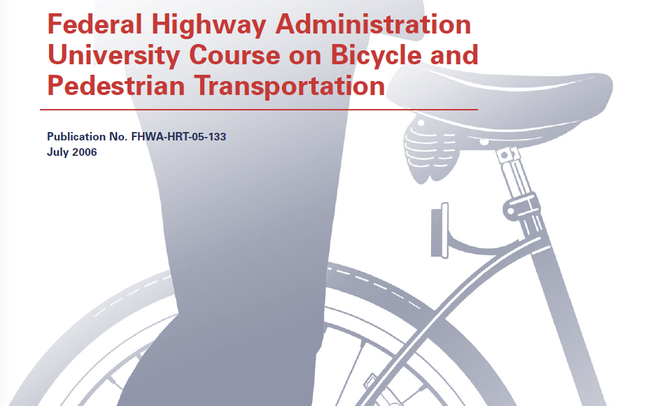
FHWA materials on the planning and design of shared bike-ped paths, from “Federal Highway Administration University Course on Bicycle and Pedestrian Transportation” (Publication No. FHWA-HRT-05-133, July 2006; see Chapter 19, Greenways and Shared Paths), confirm that our common-sense concerns about the safety of both pedestrians and cyclists on a path set in an established park are quite relevant and valid. With its mix of customary “pedestrians”, who are in reality park-users who happen to be on the paved path, it seems clear that the planned shared use path in Riverside Park is inappropriate, absent severe restrictions on cyclist speed. Indeed, such restrictions may only be achievable by requiring that bicycles be walked through Riverside Park.
The FHWA Course referred to above is almost 500 pages long. But, click here for a 7-page set of excerpts from the Chapter on Share Used Paths. Here is a sample of relevant points:
- “The popularity of many urban paths has shown that large volumes of pathway traffic, with a diverse user mix, can create congested and conflictive path conditions similar to that on urban highways. Therefore, planning and design of shared-use paths must be done with the same care and attention to recognized guidelines and user needs as the design of on-roadway bikeways and other transportation facilities.”
- “Shared-use paths are typically used by a diverse set of users representing different travel modes, using different types of equipment and traveling at different speeds. It is important to understand, even within the basic user categories of bicyclists, pedestrians, and skaters, how diverse path users can be.”
 “In addition to diverse users and a variety of equipment used, shared-use paths serve a wide variety of trip purposes. User behavior, such as travel speed and willingness to make stops, varies considerably with different trip purposes. Especially in urban and suburban areas, paths are routinely used for commuting to work or school, running errands, visiting friends, getting exercise, observing nature, and seeking recreation and enjoyment of the outdoors.
“Moreover, people of all ages and abilities use and enjoy shared-use paths—from the very young to the very old, from the novice cyclist to the marathon trainer. Accommodating and balancing the various needs created by this diverse user market is a central challenge for today’s shared-use path planners and designers.” [emphases added]
- “Too often, agencies charged with creating a shared-use path fail to understand or adopt a crucial pathway planning principal—that by definition, shared-use paths serve both transportation and recreation functions. As such, they must be planned and designed to be a part of two systems of community infrastructure: parks and recreation, and transportation.”
- “The most common feature of many greenways is a trail…with so many types of users in the United States, there are many types of trails, and elementary though it may seem, it is important to distinguish among them. All greenway trails should be compatible with the natural landscape and its functions.

 Despite its 79-page length, the draft Bike Schenectady Plan shows no indication that our City and County planners and politicians have considered how different from a policy, practicality or public-relations perspective it is to impose a shared-used transportation function on a path used for more than a century for passive-park recreational purposes, as compared to “merely” constructing a path through a hitherto unused or underused portion of land along a river, or through a new development, where a culture of shared-use etiquette and expectations can be nurtured.
.
Similarly, the Plan spends considerable space discussing the attitudes and goals of various types of cyclists [see page 2-1, which describes four basic types, including Strong & Fearless(<1%) and Interested But Concerned (60%)]. But, not a word is presented to suggest there are also very different kinds of pedestrians, with greatly different ages, abilities, activities/goals, and tolerance for the presence of cyclists. Most important, there is no indication that the Schenectady Bike planners appreciate the possibility that a significant number of current and potential users will be literally scared away by cyclists in any large numbers going through the Park at more than a very leisurely pace. Mothers with strollers or a handful of youngsters to control, and the elderly or the vision-impaired, who can be startled into a fall even without a collision, are two such groups.
 Likewise, there is no indication of an appreciation by the authors of the Bike Schenectady Plan that (1) factors making a 10-foot wide shared path in Central Park acceptable do not exist at Riverside Park (such as, other paved spaces for stopping to chat or to observe the sights, scores of acres upon which to play, and a fenced playlot); (2) a much wider path would be needed in Riverside Park to ensure the safety and comfortable use of its path by pedestrians or cyclists. For example, the predominance of dog-walkers along the path, often with more than one dog at a time, needing to stop and wait for a dog to do its doggie business, makes quick action and movement, and constant attention to approaching bikers, by the dog walkers quite problematic. And, (3) “education” without consistent “enforcement” activity, is most unlikely to change the behavior of a significant proportion of bicyclists who fail to indicate their approach orally or with a bell.
Follow-up: Given the expected users of the Riverside Park path, the 2012 AASHTO guide, which is the standard that NYS DOT uses, would require more than a 10’ wide shared use path (in addition to 2’ buffers, and 3’ clearance for signs and trees). See this quote from the “AASHTO Guide for the Development of Bicycle Facilities” (2012), Chapter 5: Design of Shared Use Paths:
5.2.1 Width and Clearance
The minimum paved width for a two-directional shared use path is 10 ft (3.0 m). . . . . . Wider pathways, 11 to 14 ft (3.4 to 4.2 m) are recommended in locations that are anticipated to serve a high percentage of pedestrians (30 percent or more of the total pathway volume) and higher user volumes (more than 300 total users in the peak hour). [emphasis added]
In our posting last year, we made this observation concerning bicycles and safety in our Schenectady parks:
 PARK SAFETY. The bicycling safety rules for all Schenectady Parks appear to be reasonable and appropriate. They require that bikes only be used on Park driveways-roadways, and at a speed less than 15 mph. Similarly, citywide provisions ban those over ten years old from using a bicycle on a public footpath or sidewalk that is intended for use by pedestrians (see Code sections montage to right; click on it for a larger version). Ignoring those limitations, and indeed encouraging bicycling in Riverside Park, without at least providing a separate pedestrian path (an alternative suggested in the City Urban Bike Route Master Plan), seems inappropriate and ill-advised. “Feasibility” of the Trail extension must take into account the City’s policy for preserving the safety of its park users.
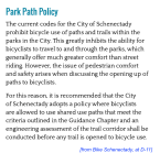
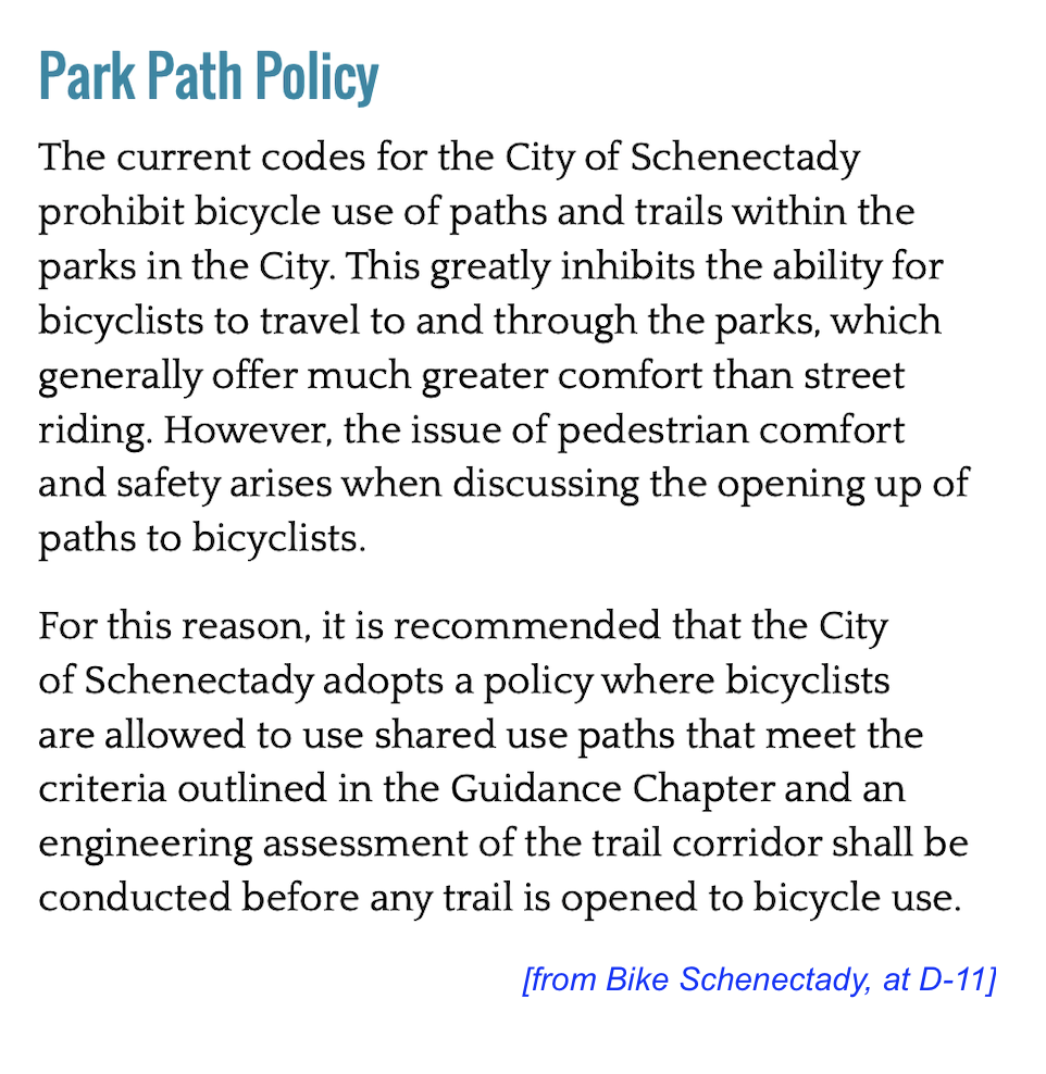
 The draft Bike Schenectady Plan text speaks of “policy” changes to the Schenectady Municipal Code that would “open access to park pathways to bicyclists.” Thus, the Policy section states (App. D, at D-11; emphases added):
Park Path Policy
The current codes for the City of Schenectady prohibit bicycle use of paths and trails within the parks in the City. This greatly inhibits the ability for bicyclists to travel to and through the parks, which generally offer much greater comfort than street riding. However, the issue of pedestrian comfort and safety arises when discussing the opening up of paths to bicyclists.
For this reason, it is recommended that the City of Schenectady adopts a policy where bicyclists are allowed to use shared use paths that meet the criteria outlined in the Guidance Chapter and an engineering assessment of the trail corridor shall be conducted before any trail is opened to bicycle use.
-
- This is an admission that the current Schenectady Code, by its plain language, does not permit bicyclists (unless under 10 or handicapped) on paths such as the one in Riverside Park.
There are doubtlessly many more points that could and should be made, and many other factors that have apparently been overlooked by Bike Schenectady proponents who are more focused on creating a transportation option for cyclists than on the impact to a special neighborhood park. Readers with different experiences, recreational desires, and physical needs than the author of this website surely can make a litany of relevant concerns. Riverside Park has long been recognized as a unique treasure along the Mohawk:
- On January 26, 1998, a Resolution of the Schenectady City Council resolved, that Riverside Park “is recognized as a unique component of the [Stockade Historic] District and best serves residents and visitors as a quiet place to view the natural beauty of the Mohawk River.” In addition, the Resolution stated that “to change its special nature would deprive visitors and disadvantage the homeowners who are the caretakers in this Historic District of national importance.”
- Indeed, with its combination of urban waterfront beauty and relative tranquility, Riverside Park was praised by the editor of Architect Forum as “probably the finest thing of its kind in America.” (Dec. 1961)
 . .
. . 
Let’s Make Riverside Park a Pedestrian Sanctuary. As is argued in the Schenectady Gazette Guest Column “Preserve Riverside Park for pedestrians” (May 4, 2018, by David Giacalone; click on the above screenshot of the Column, or here for 2-page pdf. version):
Let’s preserve and promote what is best about Riverside Park by making it a pedestrian sanctuary so that users can continue to stop and chat, walk dogs, or view the river. Those with bicycles could enjoy the park as a park, by dismounting and walking their bikes, or staying awhile.
 . . . When the Mohawk River Trail reaches Riverside Park, cyclists should dismount and walk their bikes the short distance across the park, or use any of the five streets that dead-end at the park to connect with the on-road bike path.
Close-by parking and lack of significant inclines and barriers at the end of those five streets make Riverside Park especially accessible for older and younger park users, and therefore especially appropriate as a pedestrian sanctuary.
 Raise Your Voice & Your Pen. If you are concerned about the impact of a shared-used bike path in Riverside Park, please do not merely smack your head or give up in despair over another Dorp Done Deal. Although Bike Schenectady has been approved as setting forth a framework, each segment of the City bike infrastructure is still being evaluated, with the Mohawk River Trail segment undergoing engineering and feasibility studies.
-
Let members of the Schenectady County Legislature know your opinion about Riverside Park’s relationship to Bike Schenectady. Contact the Legislature. [updated May 2022:] Consider contacting Members such as Anthony Jasenski, the Chair; Omar McGill [email], who represents District 1, which includes the Stockade, and who lives less than a block from Riverside Park; and Richard Patierne and Randy Pascarella, who also represent District 1. Mr. Patierne is Public Facilities, Transportation & Infrastructure, Chair; and Mr. Pascarella is Vice-Chair of the Environmental Conservation, Renewable Energy, & Parks Committee. Contact the County Legislature here.
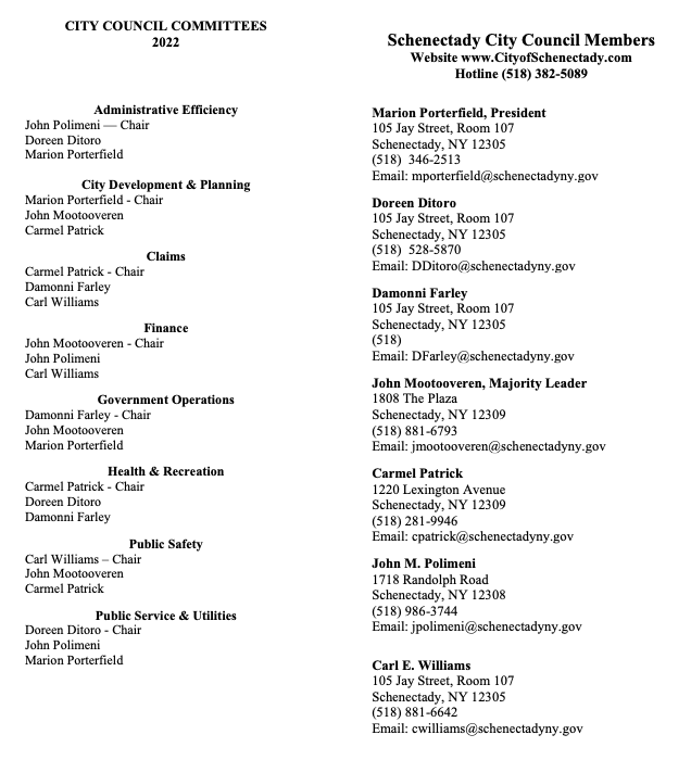
 Ask the members of the Schenectady City Council to take charge and responsibility for whether the Riverside Park pedestrian walkway is to be designated as a part of the City’s off-road cycling network. I think they are as surprised as we here in the Stockade to learn that the Bike Planners consider Riverside Park to be an existing part of the off-road cycle network. The bike path could do significant damage to the usage, users, and essence of the Park. Click on thumbnail list to the left for contact information and committee assignments.
- Let the media know of your opposition.
.
. . Share this posting with this shorter URL: http://tinyurl.com/RiversideBikes2
follow-up:
follow-up (November 1, 2018): Doing some research on a related topic today, I found a discussion about hike-bike trails and parks that I just had to include at my site. It comes from Trail Design Guidelines for Portland’s Park System (Portland OR Parks and Recreation, May 2009) , section on Hiking and Biking Trails (at p. 35, emphasis added):
USERS Walking and biking trails serve the greatest diversity of users: pedestrians, including those with fitness and balance limitations; cyclists, particularly those using road bikes; scooters; skateboards; rollerbladers; wheelchairs; and electronic mobility devices used by persons who need assistance to be mobile. People of all ages walk, run, ride, and roll to enjoy the environment, socialize, exercise, and access other parts of the community. Since user speeds can vary substantially, this trail type requires extra courtesy in sharing the trail.
Many existing park trail systems were not designed for bicycles, although cyclists often ride to parks and young riders may come to develop bicycling skills in the park. If a city bikeway is allowed to connect to existing park paths, it is important that commuting cyclists slow down. In some sites, park character, sight distance, trail width or pre-existing uses (playgrounds, playing fields, natural resource protection, off-leash dog areas) may be negatively impacted and the bikeway system should not connect to park trails. In other sites, adding new bike trails or widening existing walking trail may be needed
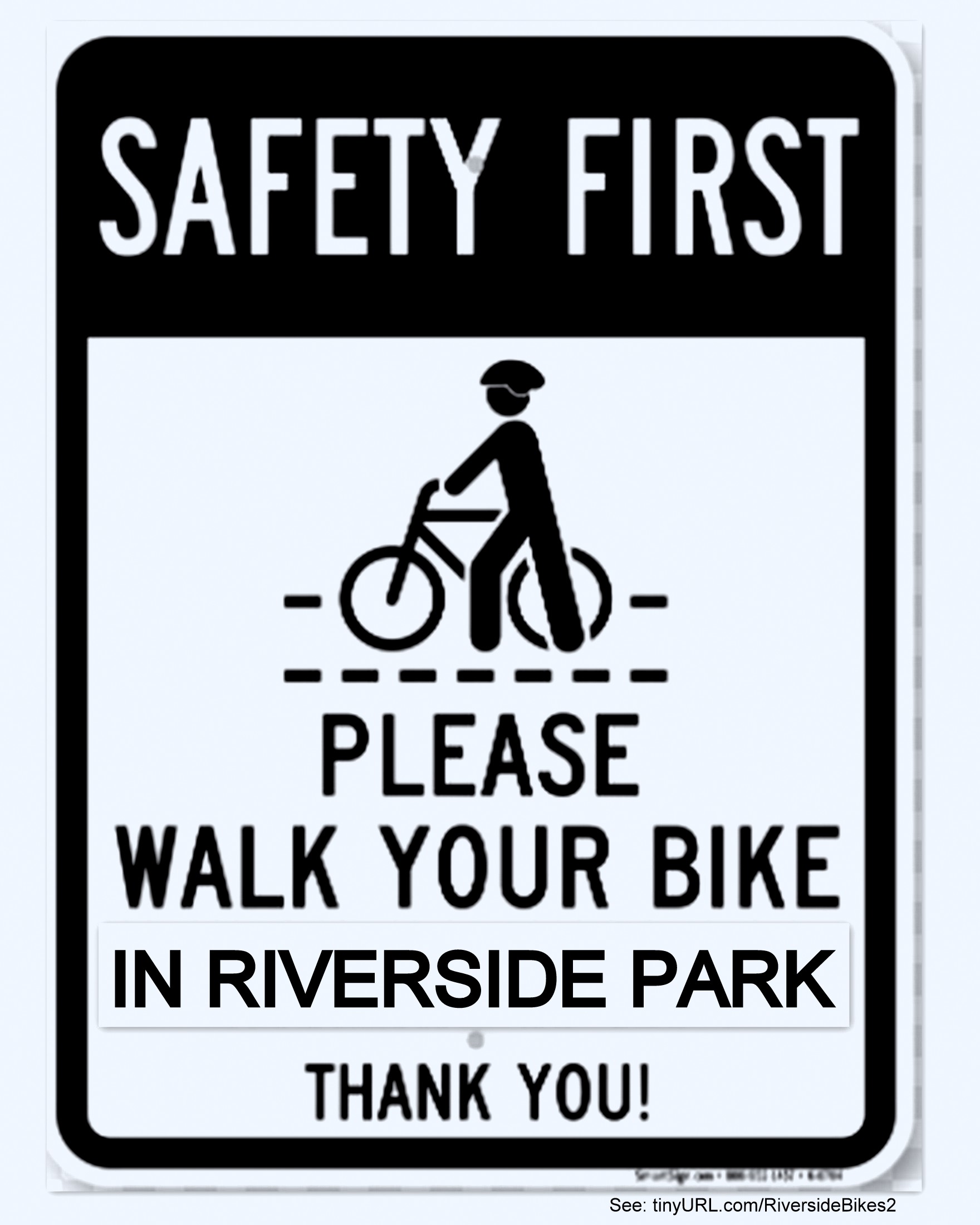
. and, consider posting our sign(s), online or in the real world:


 . .
. .  . . . Friends of Mohamed A. Hafez look forward every year to his early-August bar-b-que picnic, which at times — like today — coincides with his birthday. Mohamed throws it on the lawn, under trees, alongside his Crane Insurance office, on Crisler Avenue. I went for the first time last year, and greatly enjoyed the people and food, and low-key, friendly ambiance, that fits so well with Mohamed’s personality. And, today was a wonderful repeat of all of these elements, with the bonus of lovely weather and sunshine that made many of my photos glow.
 Like last year, Sonny the Macaw got a lot of attention, so you’ll see more of him in the Slideshow, in which the photos are presented in the order they were taken. I wish I had gotten there sooner, and got to meet some of the guests who had to leave early. A most pleasant Sunday picnic resulted in a rare “Visits Elsewhere” posting here at “suns along the Mohawk.”


![';[]pp[p[p[p](https://giacalonephotos.com/wp-content/uploads/2017/06/rainbow24jun2017e.jpg)

Recent Comments